October 2023 Weather Outlook's Impact on Reduced Tillage and Cover Crops
Written by: BAM Weather + ForGround by Bayer Experts
It’s the heat of harvest season and we know your decisions depend on the weather. So we’re teaming up with BAM Weather meteorologists to bring you a detailed, region-specific weather report.
This report isn't just a forecast; it's a helpful tool to make smart choices for your farm. Contained in this outlook is a regional weather analysis, including precipitation, temperature trends and agronomic insights to help guide your planning.
Temperature Outlook

Overall Outlook for the month of October favors a warmer west and cooler east look. Due to the beginning of the month starting out well above normal for the OH Valley and Great Lakes, the overall monthly average will be seasonable to slightly above normal.
We note a cooler risk to the forecast due to an anticipated pattern change towards the second half of the month. As we work towards ~Oct 22nd -23rd, a strong cold front can potentially work through the Northern Plains through the OH Valley and this front would welcome a more established cooler east warmer west look to close the last week of the month. Pattern driver support from East Asia and the North Pacific support this thinking. An active southern (tropical) jet across the southern third of the US and along the East coast will keep temperatures seasonable to slightly below normal due to rain induced cooling in addition to SE low pressure.
>>>>> What Does This Mean for Your Farm?
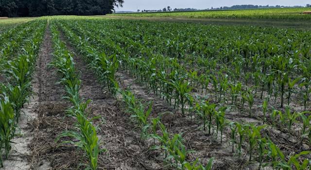
Soil temperatures are still near or above 50°F for many areas, but they change daily with air temp, residue cover, and soil moisture. If cereal rye is your choice, it can germinate down to soil temperatures of 38°F. Utilize tools, such as the Midwest Cover Crops Council selector tool for tips on selecting the right cover crop species and planting considerations. It looks like the weather is going to give us some time to get the cover crops in the ground.
Precipitation Outlook

There will be some favorable flow from the Northwest sitting across the Central US in between the below normal temperatures (trough) in the East and above normal temperatures in the Pacific Northwest (ridge) active flow will work over the top of the high pressure in the NW as well. In a similar position to where cooler temperatures set up along the southern tier of the US, the tropical jet will be rather active for the South Central and the East Coast.
Suppressed precipitation will be a risk for the OH Valley and Great Lakes as cold fronts that work through from the Northwest will create northerly, drier air from Canada. There will not be as much of a moisture tap as a result. The risk to this would be for the strip of above normal precipitation to press further east by a state should the fronts trend weaker. However, should there be some stronger than expected fronts, these can reach as far as the deep south that can also work to suppress the tropical jet flow.
>>>>> What Does This Mean for Your Farm?
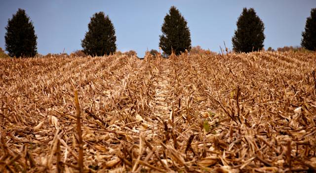
The low chances for above normal precipitation in some areas decreases the confidence for having moisture for cover crop growth this fall. However, those dry areas could keep harvest moving along and allow for more drilling of cover crops to help with early seed establishment. Drilling vs. broadcasting this time of the year can help with germination rates and still get adequate growth if the weather cooperates.
Regional Forecasts - October 10-16, 17-23
Midwest
Well Below Normal temperatures on the scale of 5 - 10 F below normal will continue for the Great Lakes and Upper OH Valley through Thursday of this week. Aside from a brief and short lived build-in of warmth towards the weekend, (Friday - Saturday) below normal temperatures will fill back in again towards the OH Valley and lower Ag Belt. Overall the Northern Plains looks to fare towards seasonable across week 1.
We will need to watch for a substantial cold shot towards October 21st in the end of week 2 and for data to trend cooler for WI, MN, MI and the OH Valley. A strong low pressure system ongoing from October 11-15th will bring a widespread swath of 1 -3 inches of rain in N NE, S SD, IA, S MN and the upper OH Valley and Great Lakes. After this system exits, another light sneaky shot of rain can work through from the 18th-20th.
Outside of this small storm system, the week 2 time frame looks well below normal for precipitation. A strong cold shot in the end of the week 2 timeframe would only further exacerbate this risk, especially for the Great Lakes and N IL, IN and OH.
West
A persistence pattern of above normal temps will average out in the Rockies and especially the High Plains near the international border. The only period of well below normal temperatures will occur from October 11-15th on the back side of the Central US strong storm system. There will be potentially heavy snow accumulations in the Front and Sawatch range (6-12”+) and Laramie Mountains during this time as well (12th/13th).
Above normal temperatures quickly fill back in towards Monday the 16th, and will persist throughout the entirety of the week 2 period. The Southwest looks to fare very dry over the two week period, as there is a lack of a tropical jet to bring in moisture. Better chances for above normal precipitation will be across the coastal regions of WA + OR. This same flow pattern can work from the northwest to southeast along the High Plains in MT and CO.
Southeast/South Central
The Southeast also holds a persistence pattern for below normal temperatures in both the weeks 1 and 2 timeframe. Out of the four geographical regions discussed, confidence is highest from a forecast perspective for temperatures to consistently run 2 -5 F below normal. The days 7 -11 time frame will hold the most pronounced colder temperatures, where they will be running 5 - 10 F below normal. This coldest window is associated with cold sinking air behind the Central US storm system. Colder risks would also need to be considered post October 21st than what model data is suggesting due to the signals in the West Pacific.
Coastal locations of the Deep South and SE GA + FL will receive above normal precipitation in the week 1 time frame due to a disorganized cluster of tropical thunderstorms developing in the Gulf towards the 13th and lasting through the 15th. There is a low end risk this cluster can form a weak tropical storm or depression, but this is not favored at this time. Behind this wave of thunderstorms, it will dry out with the coupled well below normal (5-10 F) temps in the 7-11 day period. This dryness looks to persist into week 2 with the exception for an active tropical jet keeping rain chances at play for FL.
Northeast
Persistent and meandering low pressure systems over the Great Lakes Region will keep temperatures faring slightly below normal throughout both of the week 1 and 2 timeframe. A second, defined low pressure system will enter towards the 14th of October that will keep an above normal pattern for precipitation through the third week of October. This system looks to dissipate towards the 18th of the month.
An active Southern Jet with moisture from the SE Coastal Regions of the Mid-Atlantic will also aid in additional rain chances to meander/parallel the East Coast. The ensemble data runs the risk of being too dry along the coastal regions of the US in the week 2 timeframe granted a more active jet pattern, but locations in the interior NE run the better risk of being drier. We will need to watch for week 2 data towards October 20th - 24th to be even cooler as some pattern drivers in the west pacific favor colder risks.
Looking Ahead: November Weather Outlook
Temperature
 The November forecast favors a warmer than normal look for the northern third of the United States along the Pacific NW, N Plains, Upper Midwest, Great Lakes, and Northeast. Cooler than normal temperatures will reside in the South Central and Southwest United States. While the Southeast is placed in equal chances (and portions of the Deep South). A more active tropical jet will pose a cooler risk here due to rain-induced-cooling.
If there were to be a colder period to the forecast across the Midwest and Ag Belt, it would be during the first week to 10 days of the month most likely. Historical Niños would favor a warmer look as well in the midwest (analog years 2009, 1994, 2006). However some of the stronger El Niños (1997, 2015) can help to limit well above normal temperatures when blending these two ideas together. Higher confidence is present that the Southwest and South Central will remain below normal.
Precipitation

Two flow patterns will potentially be at play for a path of precipitation in November. The first track will be for storm systems to run through the C US and into the lower Ohio Valley. The second path of flow will be related to the tropical Jet where storm systems can form in the Western Gulf and track east along the Deep South and then up the East Coast. Due to above normal temperatures for the northern third of the US, these locations will run the risk of below normal precipitation combined with historical Niño Support.
The lowest confidence areas will be in WI/ S MN and W MI as it will come down to how much moisture and how strong some storm systems can be once they track from the Southwest to Northeast into these locations. Top analog years of 1994, 1997, 2009, and 2006.
Soil Moisture Forecast

Due to a historically dry period for the AG Belt in late August- Mid September and recently the Ohio Valley, these locations will continue to run the risk of prolonged soil dryness. There will be a strong low pressure system affecting these locations towards October 12th - 15th with a decent swath of 1 -2 inches of rain. These will help improve conditions, but a substantial deficit remains.
Most Recent Drought Monitor with Estimated Soil Conditions Through the End of November

__Most Recent Drought Monitor With Estimated Soil Conditions Through the end of November: __
- Black or areas not outlined → neutral grade/toss up for improvement/deterioration or no strong trend.
- Leniency for locations in black to have a slight improvement in Soil moisture content over the next 6- 7 weeks through the end of November.
- Red → deterioration
- Green → improvement
Combining ideas of the remainder of October with November, there is higher confidence that locations across the South Central and SE will remain moist with an improvement in drought conditions across TX and LA. Areas at risk for prolonged dryness and a drought continuation are across IN and OH as well as the western regions of the Northern Plains getting into early November. Although not in a drought classification at present, we would need to watch towards late October into November for soils to dry out further in the Great Lakes area. Lower confidence is present along the lower AG Belt and KS +MO as stronger cold fronts in October can run the risk that these locations continue to be dry as they pull in cooler, drier Canadian air.
Watch how far north storms can track across the Central US and just how far north moisture can press into the black outlined region. The risk is that there are improvements here, but they will be marginal. Areas that reside outside of any shaded region can be classified as neutral, meaning soil quality is favored to remain similar over the next couple months.
>>>>> What Does This Mean for Your Farm?
Fall field operations are always heavily dependent on the weather and soil conditions. If applying fertilizer this fall, apply fertilizer nitrogen when soil temperature is below 50°F at 4” depth and the forecast indicates it will continue to decrease. Ideal conditions may be a while away based on current temperatures and forecast. Also, consider using a stabilizer to reduce the risk of losses because a lot of weather happens between now and planting.
One bonus for dry soil? Strip till. Fall strip till operations should be done when the soil moisture is dry enough to reduce the risk of smearing and clods, which may have to be repaired in the spring costing more time and money. However, don’t let good field conditions give you the “itch” go make unnecessary tillage passes.
ENSO Status/Pattern Drivers

(Left) Current Probabilities for an El Niño over the next 8 months. With high confidence, El Niño will continue at least through March 2024.
(Right) Sea surface temperatures departure from normal as of October 6, 2023. The right-most two green boxes are signatures of an Eastern-based Niño, where the warmest waters set up in the eastern portion of the Tropical Pacific along the Equator. These two zones play a substantial role in the remaining October and November forecast.
A strong El Niño signal continues to be the primary pattern driver to the upcoming Autumn and winter months ahead. Latest readings for official sea surface temperatures measured in the Pacific along the equator for El Niño are at +1.5 C. Our top analog years of support continue to be 1997, 2015, and 2009. Other loose years are 1994 and 2006. These historical Niño years favor a warmer/drier risk across the northern tier of the United States through November, with a risk to trend warmer as we progress deeper into November across the Northern Plains.
The global wind state of the atmosphere also continues to resemble more of a La Niña pattern (as opposed to El Niño). This also poses a risk for the forecast to lean towards warmer than average for the Midwest and Great Lakes Regions. There can be some larger systems that progress in from the Northwest that can cause rapid fluctuations in temperatures, but the base state would favor warmer than normal temperatures. The warmer risk would also cause suppression for some flow in the Great Lakes area, although there is some lower confidence to this forecast.
Key Takeaways
- Cooler weather, and even some precipitation, is coming for some areas, so stay flexible on cover crop seeding timing and method.
- The forecast is variable from week to week, so consider near and long-term forecast when timing any fall nitrogen applications.
- Portions of the Eastern and Northern Corn Belt look to be drier than normal, so don’t let the dry fields and decent temperatures create unnecessary tillage passes.
Resources: 1.) https://cropwatch.unl.edu/2019/considerations-fall-fertilizer-nitrogen-application)
Legal Statements ALWAYS READ AND FOLLOW PESTICIDE LABEL DIRECTIONS. Performance may vary, from location to location and from year to year, as local growing, soil and weather conditions may vary. Growers should evaluate data from multiple locations and years whenever possible and should consider the impacts of these conditions on the grower's fields.