Early Spring Weather Outlook and Agronomic Considerations
Written by: Tyler Williams, ForGround by Bayer Sustainable Systems Agronomist + Will Danby and Bret Walts, BAM Weather Meteorologists
Agronomic Summary
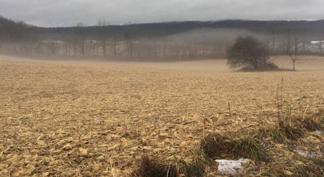
Recent precipitation events and warm up have likely made things look and feel a little more like spring. For many, the recent cold was unpleasant, but the blanket of snow likely provided moisture and protection for those over-wintering cover crops or cash crops.
Looking ahead, a warm pattern in February in the northern areas doesn’t necessarily mean temperatures will allow plants to break dormancy, but it could keep soil temperatures warmer, reduce frost depth, and melt some of the snow. If the warmth continues into late February and early March, those early season weeds might start to grow a little earlier, especially in no-till fields. In the south, a cooler and wetter pattern may limit the early season field work.
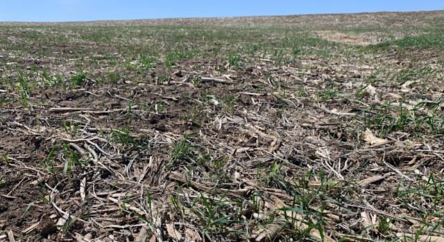
In the extended outlooks, if normal or cooler-than-normal temperatures, coupled with areas of above normal precipitation, come to fruition, this could mean delays in planting in fields with heavy residue and slow cover crop growth. Although this is still far out, cool and wet springs can be challenging for no-till or cover crop systems; however, last year we saw severe drought stress on crops with cover crops due to the lack of moisture. Cover crops can be a tool when we want to use up the excess moisture. Stay tuned and have a plan on how to best utilize your cover crops to save or use some of that moisture.
February Temperature and Precipitation Outlook

Temperature: The Northern Plains, Great Lakes and AG Belt will experience very mild air for February standards. The warmest portion of the month will be during the first half with the core of the warmth shifting east slightly into the interior Northeast. Cooler temperatures will sit along the lower US where the pattern will be rainy as well.
Precipitation: Two favorable flow patterns can setup during February. Where the cooler air sets up along the SE, some active storm tracks for low pressure systems can traverse across the Deep South and Mid-Atlantic. Active southwest flow from the Pacific Ocean can allow for another flow pattern of storms up the central US, however there are risks this can trend drier, as there is some variability for how far north moisture can press.
February 13th - 26th Temperature & Precipitation Outlook

Temperature: Watching near the February 15th - 20th timeframe, abnormal warmth across the upper US can start to retract with a shift to cooler air lifting north into the Southwestern US and Mid-Atlantic. There are risks this can trend cooler near the Ohio Valley and Northeast especially into the last week of February.
Precipitation: The South Central and Southeastern US will see an active flow pattern that will keep the region rainy. There are some risks for the Lower OH Valley to become more active post February 14th and into the last week of the month.
March Temperature and Precipitation Outlook

Temperature: March will be an interesting month denoted as the ‘wild card’ month. This will depend on the nature of how cooler air can setup across the eastern US into Late February. There certainly would be colder risks to the Midwest and Ohio Valley as a result. This month would also be the greatest risk month for cold snaps out of February, April and May.
Precipitation: Higher confidence exists that there will be some active southwest flow across the Southwest United states for March. Locations that can run the risk to be drier would be on the West coast, mainly in California. The Gulf Coast and Great Lakes both have wetter risks should the southern jet (tracking of southern storms) verify stronger.
April Temperature and Precipitation Outlook

Temperature: The southern half of the United States will likely fare cooler with a weakening El Niño, with warmer temperatures locked across the northern third of the US. There would be risks for this warmth to expand further east into the Ohio Valley and Northeast.
Precipitation: Higher confidence exists that the OH Valley and northern portions of the Great Lakes will be drier than normal as the El Niño fades into more of a neutral state. The Central Plains will likely remain active with shots of precipitation. Analog support would suggest that the Southeast US can see drier risks.
May Temperature and Precipitation Outlook

Temperature: Coastal regions will likely see the coolest temperatures while the central US would be at risk to be warmer than normal. Areas at risk to trend warmer would be across the East.
Precipitation: A neutral May for the ENSO would pose formidable dry risks across the Ohio Valley and Eastern portions of the AG Belt. It is likely the growing season is going to start out drier than normal for much of corn and cotton - dense regions. Locations at greatest risk to trend even drier would be across the Deep South.
Cold Snap Risks for Remaining Winter?

If there will be opportunities for prolonged cold periods or cold snaps -- late February and the month of March will need to be monitored closely. While favored analogs are far warmer in March for the Northern Plains, the last cold snap that has just happened recently in the second week of January would pose risks for a polar vortex breakdown for a second time in March (coldest air from the planet breaks down from the North Pole into the US). Here are risk analog years for both temperature and precipitation that had January Polar Vortex break downs. The Northern Plains would have the highest risk for cold snaps.
March, April and May Composites

Here is the upcoming seasonal outlook when blending March, April and May together for both temperature and precipitation. Risks to the overall seasonal composites would be for the East Coast to verify warmer and the Western Plains to be cooler. The Northeast can trend wetter and the OH Valley and TN Valley have risks to trend drier, especially towards early April into late May.
Current Drought Status & Forecasted Areas of Improvement or Degradation

Current Drought Status as of January 9th, 2024. The Deep South and Isolated areas of the AG Belt are currently experiencing the worst of drought conditions. Iowa especially continues to run in a deficit from how dry May - August 2023 was. The late summer developing drought in 2023 for the Deep South has remained established as well.
Areas in green denote improvement to the current drought while orange and yellow areas suggest a degradation. The Deep South has higher confidence for drought improvement given how active storm tracking will be across February and March.
The Ohio Valley Would run risks of a drier forecast over the next 2 months. This is still in line with typical El Niño winter into early spring.